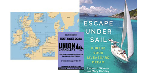
Union Chandlery is Ireland’s leading Marine and Yachting supplies store, including the best brands: Vetus, Torqeedo, International paint, Whale and much more…..


UNION CHANDLERY GIFT CARD
The perfect gift for the Marine enthusiast in your life!

Loving your new store and great Chandlery advice as usual! Thanks guys.
Great to have a wide variety of sailing gear in a retail setting.
Great staff very good advice got exactly what I needed
Excellent advice and service
UNION CHANDLERY NEWS
New Vetus Catalogue 2024/25
The 2024/25 portfolio includes exciting new products, as well as an array of acclaimed systems and equipmentwhich have been selected by boaters and boat builders for decades. Download here : https://online.flippingbook.com/view/1047273911/
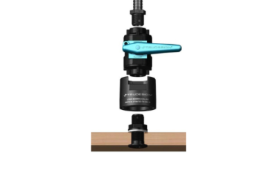
TruDesign Composite Fittings
Union Chandlery is proud to supply TruDesign Composite fittings for boats in Ireland. Tru-Design range of Fittings are the first composite through hull fittings to becertified by the Int. Marine Certification Institute (IMCI) Belgium. Designed andmade in New Zealand,...
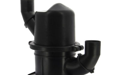
Vetus Navidurin Waterlocks
HPW Waterlock made from Navidurin VETUS proudly presents NAVIDURIN® Waterlocks and Waterstrainers : • A special composite blend which is capable of handling temperatures up to 260° C • Optimized for use in recreational and commercial vessels • Superior to...
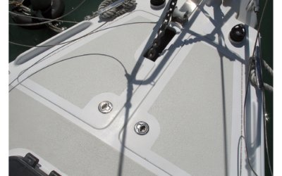
Getting to grips with KiwiGrip !
All you need to know to create the right texture on your boat deck or even your decking at home can be found in the links below : https://www.youtube.com/watch?v=ztJY7xNio0Q Available to buy here : https://uchandlery.ie/kiwigrip-non-slip-paint/ More info in text...


"Included in the price of LED bulbs/lights is a contribution to recycling cost of €0.05"

23 Doughcloyne Industrial Estate, Sarsfield Road, Cork. T12 DR97
Any queries email us at [email protected] or
telephone the mail-order department at +353 (0) 21 4554334
*Prices on website are for orders placed online only and may differ from in-store prices.
Open Monday to Friday from 09.00 - 16.00. Saturday 09.00 - 13.00. Closed Sundays & Bank holidays.
S